What is this consultation about?

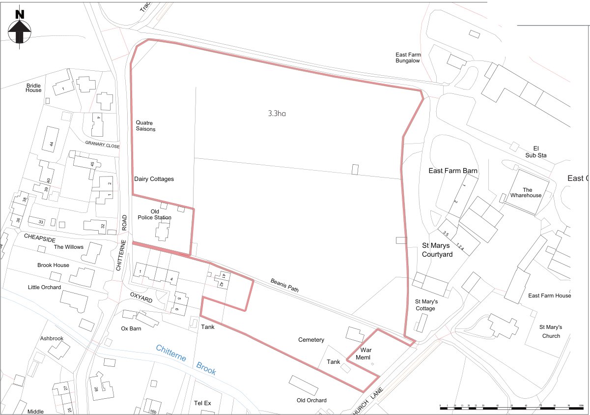
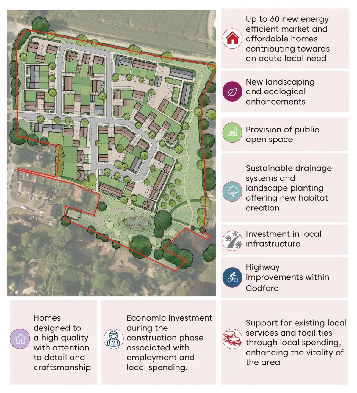
The purpose of this online consultation is to seek the views of community representatives and local residents on our draft proposals for the provision of up to 60 new homes and multi-functional green space on land at Chitterne Road, Codford.

The proposals are being progressed as an Outline Planning Application setting out the broad principles for the development of the site, not detailed matters such as architecture, design and site layout, the exception being access.

This consultation provides an opportunity for you to comment on the emerging proposals. We will aim to address the comments raised through our planning application.

The site is located on the north-eastern edge of Codford St Mary, with frontage to Chitterne Road along its western boundary. The land is currently in pasture and is partially enclosed by mature hedgerows and trees, with generally gentle topography falling towards the south.

image
image

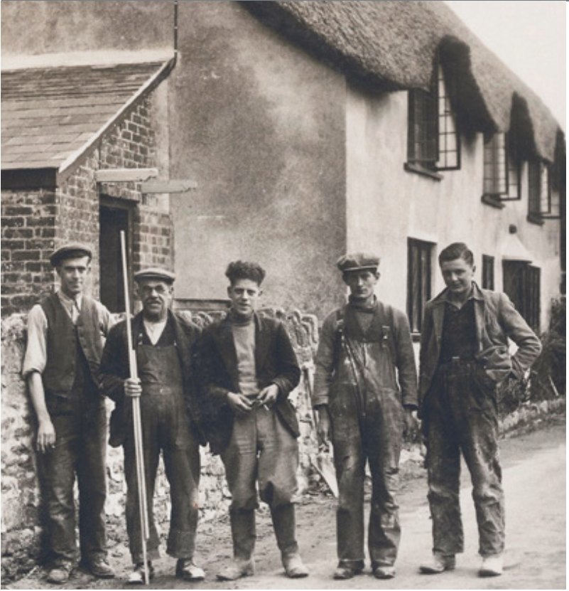
Founded over 80 years ago C G Fry is a family-owned regional housebuilder based in West Dorset, operating across the southwest from Cornwall to Hampshire and currently building around 300 houses a year.

The Company is in the ownership and control of the Managing Director, Philip Fry, and employs around 200 people across many disciplines from site operatives to professional design, surveying, planning and project management staff.

C G Fry & Son seek to deliver outstanding homes in developments that will leave a legacy for future generations to enjoy. Craftsmanship and quality have always been the hallmarks of our work, earning the Company an enviable reputation.

02 02 awards logo row

image

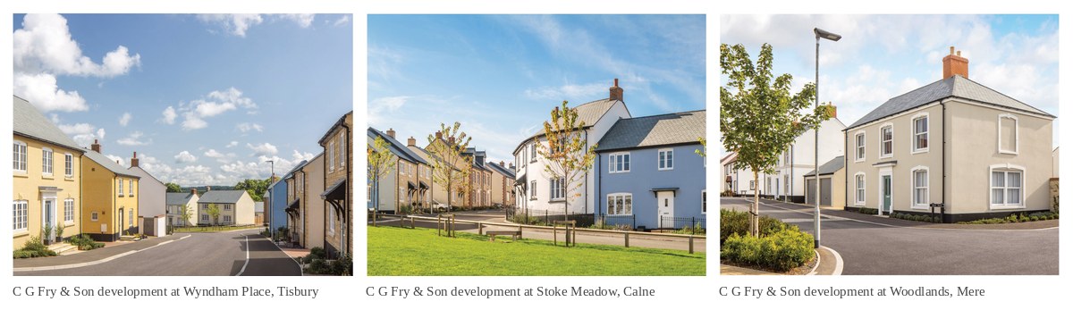
We have delivered high quality schemes in and around Wiltshire, local examples being Calne, Mere and Tisbury. We are also proud to be one of three developers delivering Poundbury, working in partnership with the Duchy of Cornwall.

Further details of our history and examples of our developments are included on our website www.cgfry.co.uk.

03 01 icon new homes neededWhy are new homes needed?

There is a significant need for new housing both nationally and across Wiltshire in part as a result of a lack of supply over the past 50 years.

The Government has made clear that it wants to significantly increase housing delivery to help tackle the housing crisis. This includes increasing housing delivery rates nationally to around 300,000 homes a year.


The Position in Wiltshire

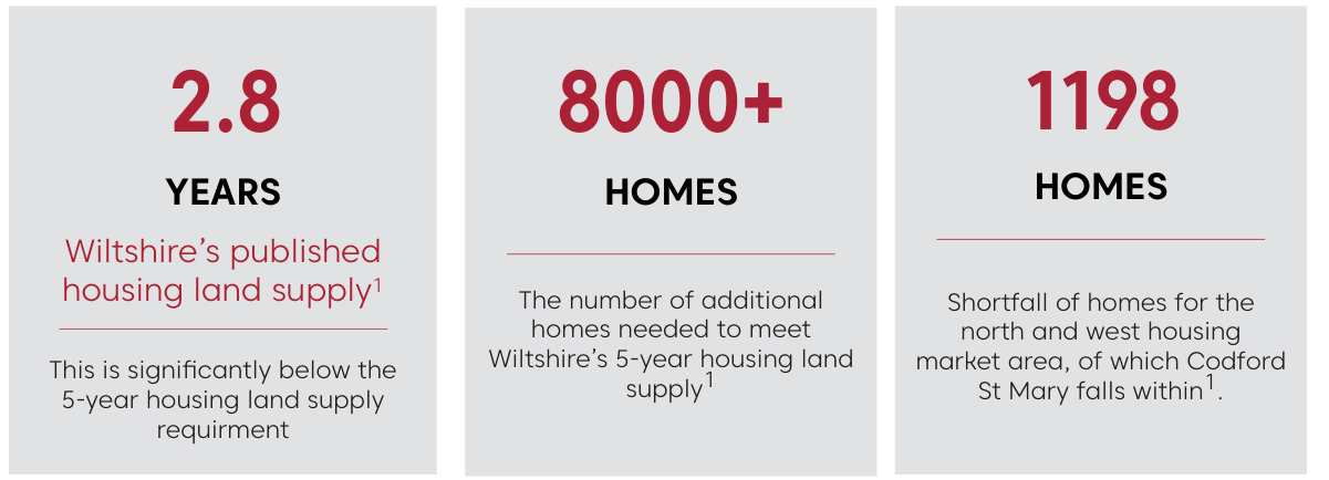
Wiltshire Council’s latest housing land supply position (published 2026) shows a significant shortfall.

image

03 03 icon housing registerDemand on Wiltshire Council’s housing register remains high: There were 4,086 total active applications for housing recorded on the 3rd August 2026, with the average waiting time in Wiltshire being 3 years and 3 months for a 3 bed home4

Sources

1. Wiltshire Council’s Housing Land Supply Position Statement (Published June 2026)

2. Current Demand on Housing Register, Wiltshire Council: 


03 04 icon how chitterne road can helpHow Land at Chitterne Road Can Help

The proposals for land at Chitterne Road will deliver much needed new high quality homes in a sustainable location, including affordable homes, helping to meet an identified need for housing in Wiltshire.

image

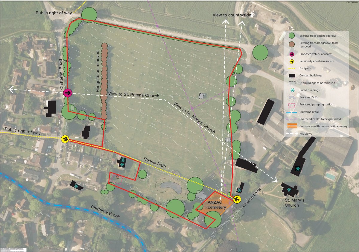
Site investigations have informed the following key considerations. It is important to note that technical work is ongoing and will continue to inform the masterplanning process.

image

The site’s landscape structure, relationship with the village, and visual connections to both the surrounding countryside and key local landmarks provide a strong basis for creating a distinctive and well-connected place.

In developing the proposals, a range of key site considerations have been carefully reviewed in collaboration with our specialist project team. These considerations have helped to shape the emerging proposals and are explored in greater detail on the following boards.

image

Planning decisions are guided by national policy and Wiltshire’s local planning policies. This board explains the key policies and documents when the proposals for Chitterne Road are considered by the Local Planning Authority.

NATIONAL DECISION MAKING POLICIES

National Planning Policy Framework (NPPF)

A new NPPF was published in August 2026 which sets out new national development management policies.

Draft Design and Placemaking PPG (dDPPPG)

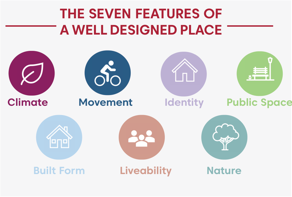
This document promotes well designed, sustainable places. It explains what is meant by the government’s seven features of well-designed places.

The Seven Features of a Well Designed Place

05 01 seven features of a well designed place

WILTSHIRE’S LOCAL PLANNING POLICY

Wiltshire Core Strategy

The Wiltshire Core Strategy was adopted in 2015 and remains part of the development plan. The policies on the distribution of housing are now out of date.

A new Local Plan for Wiltshire

Wiltshire Council is preparing a new Local Plan which will allocate new sites throughout Wiltshire to meet its housing requirement. The standard method demonstrates a need for at least 3525 new homes per annum.

The Council does not intend to adopt the new Local Plan until at least 2029.

Wiltshire Council’s Design Guide

The Wiltshire Design Guide promotes high-quality development that responds to local context and character.

image

What does this mean for Land at Chitterne Road?

The proposals have been developed with regard to national and local planning policy and other material considerations. C G Fry & Son seek to bring forward a high quality, sustainable development for future generations to enjoy.

As demonstrated through the preceding information there is a significant need for sites such as the land at Chitterne Road to be brought forward for development of new homes as soon as possible, particularly in the absence of an up-to-date Local Plan for the area. It is in this context that we are progressing an outline application now.

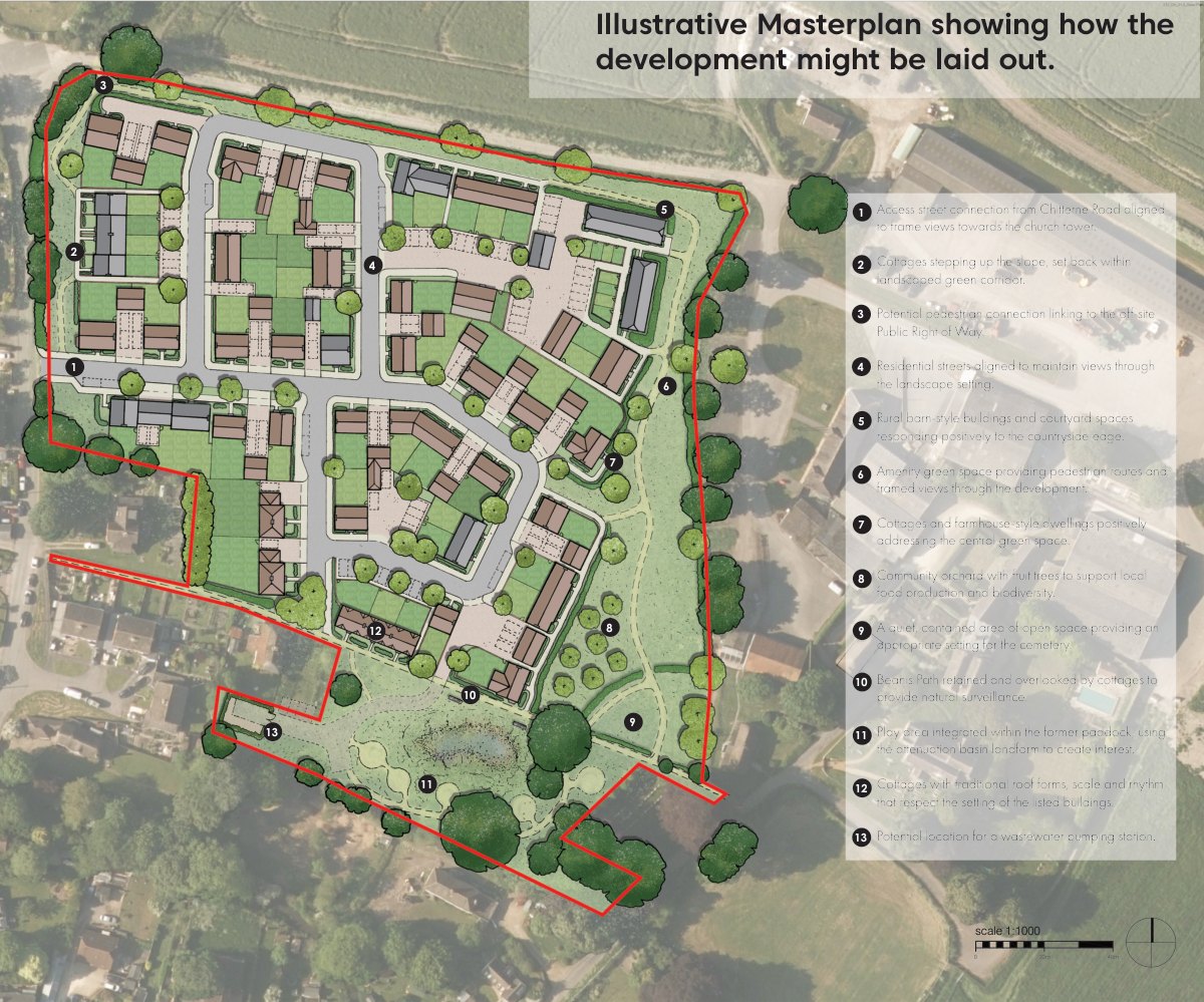
The draft proposals seek to deliver up to 60 new homes, 30% of which will be affordable housing providing a mix of sizes and tenures, contributing to the housing needs of the area and the wider national housing crisis.

image

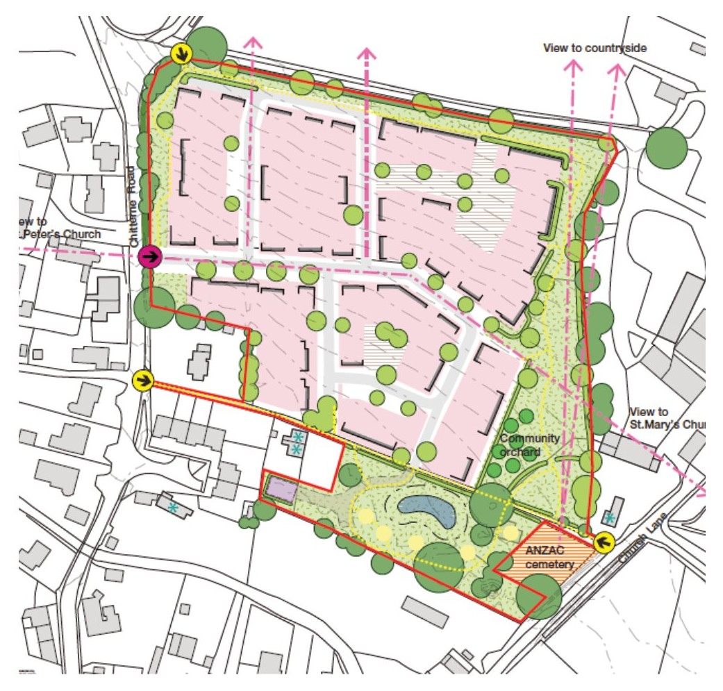
Masterplan key

  1. Access street connection from Chitterne Road aligned to frame views towards the church tower.
  2. Cottages stepping up the slope, set back within landscaped green corridor.
  3. Potential pedestrian connection linking to the off-site Public Right of Way.
  4. Residential streets aligned to maintain views through the landscape setting.
  5. Rural barn-style buildings and courtyard spaces responding positively to the countryside edge.
  6. Amenity green space providing pedestrian routes and framed views through the development.
  7. Cottages and farmhouse-style dwellings positively addressing the central green space.
  8. Community orchard with fruit trees to support local food production and biodiversity.
  9. A quiet, contained area of open space providing an appropriate setting for the cemetery.
  10. Beanis Path retained and overlooked by cottages to provide natural surveillance.
  11. Play area integrated within the former paddock, using the attenuation basin landform to create interest.
  12. Cottages with traditional roof forms, scale and rhythm that respect the setting of the listed buildings.
  13. Potential location for a wastewater pumping station.

Wiltshire Council has acknowledged a climate emergency. It has adopted a Climate Strategy (2022), a Green and Blue Infrastructure Strategy (2022) and is preparing a draft climate delivery plan.

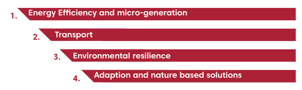
Wiltshire Council’s Design Guide sets out four key objectives for new developments to address within architecture and urban design.

image

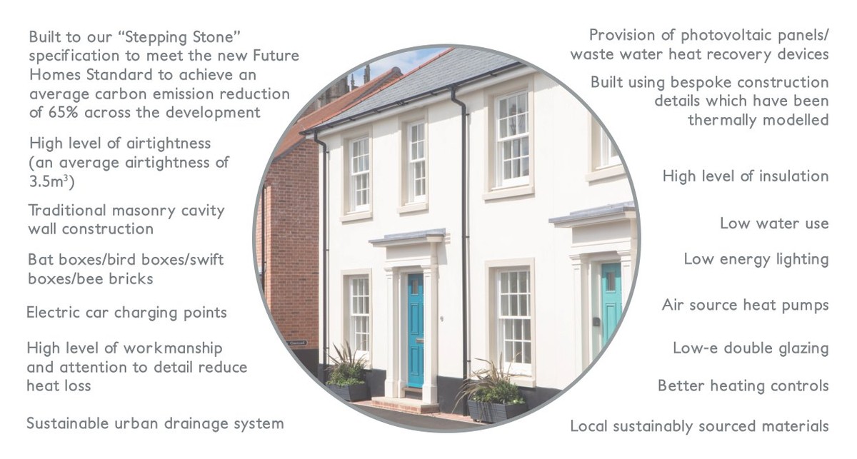
C G Fry & Son believe that building a home with a low energy demand is the best long-term way to deal with high CO2 emissions and fuel bills. The efficiency of the “building envelope” is key to this.

image

Heating, hot water and lighting is 50% cheaper: an average new build house owner will pay just over £800 a year, compared to £1,789 for those in older equivalent sized properties (yearly saving of £979).

Source: https://www.hbf.co.uk/policy/wattasave

image

Cranborne Chase National Landscape

The site sits within the Cranborne Chase National Landscape, within the Wylye Chalk River Valley. The Cranborne Chase National Landscape Management Plan is a material consideration in planning. The Management Plan sets out that development should be ‘located and designed to integrate fully with the landscape character and natural beauty’.

The Historic Environment

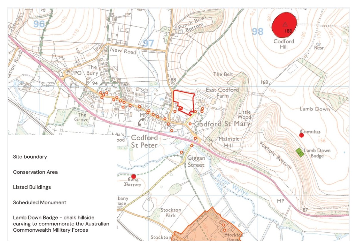
St Mary’s Church (Grade II* Listed), St Mary’s Cottage (Grade II) and East Codford Farmhouse (Grade II) sit to the east of the site. 41 and 42 Beanis Path (Grade II) sit to the south of Beanis Path and the Ox Barn (Grade II) sits to the south of the site. The Church of St Peter’s (Grade II*) spire can be seen from within the site as set out below, and the Anzac Cemetery sits adjacent to the site.

image
image

The Design Response

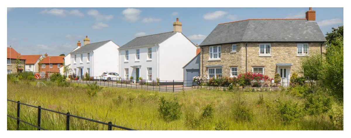
C G Fry & Son are working closely with consultants to ensure the proposal creates a place that will stand the test of time, that adds a new layer of history to the village, with the expectation that it will be valued for its heritage in the future as heritage assets are today.

  • A landscape buffer along the eastern boundary ensures separation from the farmstead, listed buildings and the ANZAC Cemetery, preserving their rural setting and context
  • Key views towards the church spires have informed the street scape
  • Retention of hedgerow along Chitterne Road preserves the green character along the approach to the village.
  • At reserved matters stage, it will be important for building materials, architectural and landscape details to respond to local character.

Site Access

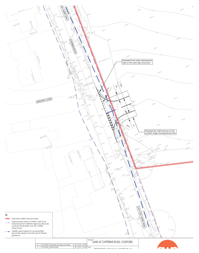
The adjacent plan shows a new vehicular access created from Chitterne Road into the site. It highlights visibility splays of 43m to the south and 44m to the north to provide appropriate visibility for access and egress.

image
image

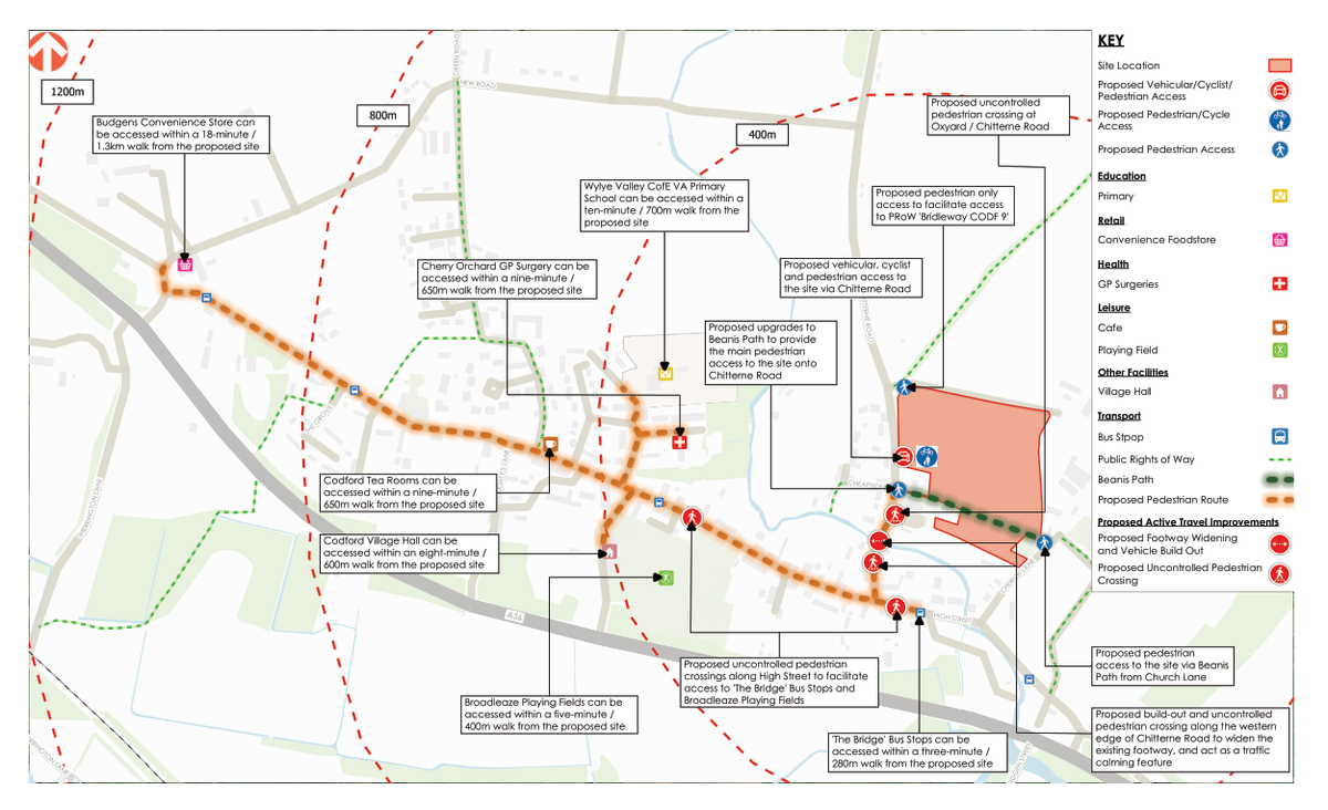
The main pedestrian access will be via the existing Beanis Path pedestrian route. Internal routes will provide connectivity to the rights of way in the local area and to the new open space within the site.

Every home will have dedicated parking with electric vehicle charging points. Further details on the parking will be provided at reserved matters stage.

A series of off-site highway improvements are also proposed to enhance active travel links in the area, as shown to the left;

 10 01 icon ecology

Ecology

A series of ecological surveys have been carried out to inform the proposals, including reptile, dormouse and bat activity surveys, these are ongoing and will be continually checked to inform final design.

The proposal will provide biodiversity enhancements including bat and bird boxes and hedgehog highways, and will provide 10% biodiversity net gain through a mix of on and off site measures.

 10 02 icon open space

Open Space

The development will be shaped around high-quality open space that invites people to live, play, and connect with both nature and the community.

The open space will feature a multifunctional attenuation basin, landscape buffers, the eastern green which maintains tranquility around the ANZAC Cemetery. These open space features will support local flora and fauna, strengthen ecological connections and will increase residents daily connection with nature.

The areas of open space will be subject to a management and maintenance plan which will be implemented by a management company. set up to maintain communal areas within the development.

 10 03 icon landscaping and trees

Landscaping and Trees

We have carried out a full survey of the health and condition of all trees and hedgerows on and surrounding the site and we have designed our scheme to avoid impacts on any features worthy of retention. Existing trees, where retained, will be suitably protected during construction by secure fencing.

The proposal incorporates trees into the street scene. These trees will be carefully selected species to ensure longevity and amenity. Other strategic planting includes bolstering planting along the site’s eastern and northern boundaries.

You may have seen a number of surveys being carried out on the field over the past year. We have been carrying out ground investigation works, including over winter groundwater monitoring to help inform on our final drainage strategy. The proposal will incorporate sustainable drainage features, including a basin / pond, currently proposed to the south of Beanis Path.

We will be working closely with Wiltshire Council’s Lead Local Flood Authority to ensure that our drainage scheme will not exacerbate flood risk, and instead will provide benefit to existing conditions.

image

In addition to the provision of on-site affordable housing, public open space and carrying out highway improvement works, as part of any planning permission that may be granted by Wiltshire Council, financial contributions will be made to a number of local infrastructure improvements through what are referred to as planning obligations.

These are secured by the Council via the Community Infrastructure Levy [“CIL”] and via a legal agreement known as a S106 agreement which also covers other matters such as the future management and maintenance of any communal areas within the development, including the open space.

The level of contributions to be secured will be agreed in consultation with Wiltshire Council.

The proposal will deliver a sustainable extension to Codford, providing;

image

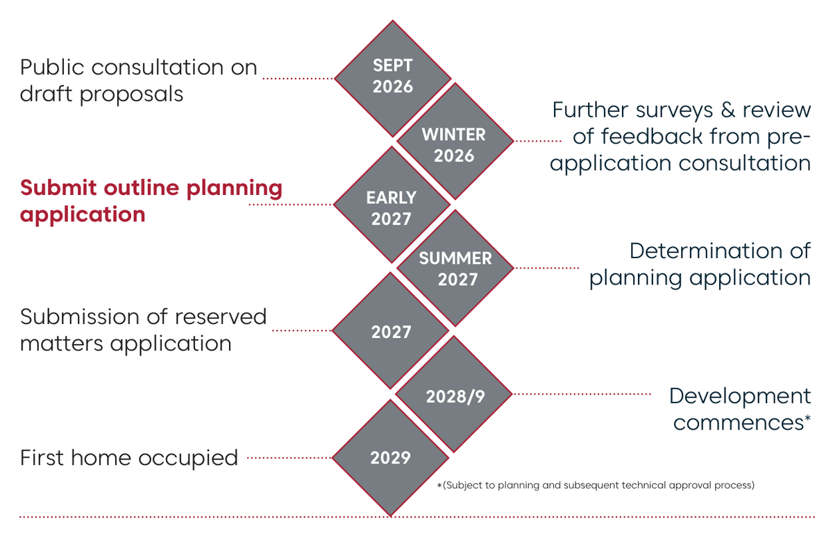
We will carefully consider the comments that are raised and aim to address them as far as possible through our outline planning application

image
image

Thank you for taking the time to look at our draft proposals. Please fill in the comments form if you have any questions 

Please let us have your feedback by 5pm on 12th October 2026


All comments received will be reviewed by the project team. Feedback will be considered as we finalise the design and technical assessments ahead of submitting a full planning application to Dorset Council. Where suggestions can be incorporated, we will do so; where they cannot, we will explain why.

A Statement of Community Involvement, summarising this engagement process and how feedback has shaped the proposals, will be submitted with the planning application. Once the application is submitted, there will be a further statutory opportunity to comment directly to Dorset Council.

Please send your feedback by using the comment form below 

We welcome all feedback, whether positive or raising concerns. Your input will help shape the final proposals before we submit our planning application to Dorset Council.

In providing a response you agree for the submitted details to be held on file for the sole purpose of informing the evolution of this scheme, and for no other purpose.  We will acknowledge all responses.  Comments will be summarised in a Statement of Community Engagement accompanying the planning application.  All personal information will be removed and care taken to ensure comments are anonymised.   No personal information will be passed to any third party.


  I have read and agree to the above statement.